DeWaltLaser tripod with 1/4" threaded mount DeWalt DE0881T-XJCode DE0881T-XJ
Position the laser level at the right height and help read its beam on site.

Laser and surveying instruments are distance meters, laser levels, rotating lasers, GNSS receivers and machine control systems, with tripods and accessories, for measuring and setting out.
Laser and surveying instruments include laser distance meters, laser levels, rotary lasers, GNSS receivers and machine control systems, with tripods and accessories, for measuring and setting out.
Used for inspecting plant, pipework and structures and for topographic surveying and site setting-out.
Set the instrument on a tripod or stable base, away from vibration, and let it self-level or level it manually. Before starting, check accuracy against a known reference and, outdoors, use the detector or staff to read the beam. Never look into the laser beam, and transport the instrument switched off in its case.
Designed for surveyors.
Reference standards: CE marking in accordance with the EU directives applicable to the total stations sector, compliance with current technical and safety standards, technical documentation supplied by the manufacturer Leica.
Monitoring solution GeoMoS Leica (Leica) — The Leica automatic system for deformation monitoring Designed for monitoring professionals, the Leica GeoMoS solution offers the flexibility needed to quickly understand and manage the complexity of today's monitoring projects. Thanks to scalable software, various options and different licence packages, the Leica GeoMoS family adapts to the specific needs of every user. Suitable for continuous or periodic projects, it is a complete, highly accurate and reliable monitoring solution. With more than 20 years of monitoring experience and support from a team of highly qualified engineers, Leica GeoMoS is an essential partner in tackling the many challenges of monitoring work. Core software Geodetic, geotechnical, environmental or any other data acquisition by sensors is ensured accurately and reliably through outlier detection, data validation, filtering and automatic re-measurement. If the system and the limit check on critical observations are active, the responsible personnel are promptly informed in various ways (email, SMS, alert). Maximum monitoring accuracy and stability are guaranteed by advanced mathematical calculations and by the combined observation of several sensors. Imaging Leica GeoMoS Imaging is a graphical extension of the existing GeoMoS solution. It is a monitoring technology that provides informative images for documentation, inspection and remote detection. The real-time view with joystick functionality and the continuous visual recording of monitoring projects increase users' productivity and provide all the information needed to make decisions quickly and easily. Visualisation and reporting Powerful, versatile and highly customisable, the GeoMoS Now! solution can be installed locally or used in the cloud, allowing you to access the results anytime and anywhere. You can receive an accurate and timely overview of the status of projects through a variety of easy-to-configure graphs, images, maps, tables and scans
Tell us the quantities you need and the intended use: if there is a more suitable version, or an equivalent available sooner, we will let you know.
For prices and availability, request a quote from AMES Srl: we will reply with our quotation, delivery times and, where needed, an equivalent technical alternative.
Everything you need in one place, from functionality to safety.
Position the laser level at the right height and help read its beam on site.
Complete levels and rotary lasers for reading the beam from a distance and mounting them anywhere.
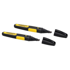
Leave clearly legible marks on wood, metal and masonry for marking out cuts and holes.
Power torches, measuring instruments and small portable electronic devices.
We use essential cookies to make the site work, and, only with your consent, analytics and marketing cookies to understand how it is used and to offer you relevant content. You can change your mind at any time. Read the privacy policy
For purchasing offices and MRO buyers
Search by task
Thank you! Your request has reached one of our buyers: we'll reply within 24 working hours with the quote or with any questions needed to complete it.